
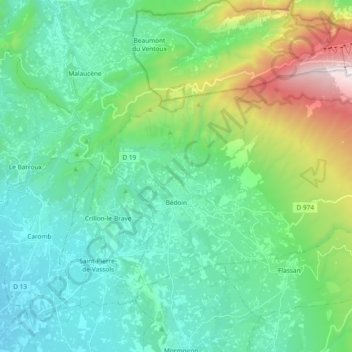
Bédoin topographic map
Interactive map
Click on the map to display elevation.
About this map
Name: Bédoin topographic map, elevation, terrain.
Average elevation: 517 m
Minimum elevation: 125 m
Maximum elevation: 1,849 m
Der Ort Bédoin liegt auf etwa 300 Meter Höhe am Fuße des Mont Ventoux auf dessen Südseite. Das Gemeindegebiet zieht sich bis an den Gipfel selbst. Durch Bédoin fließt das Flüsschen Mède.