
Thank you for supporting this site ❤️
Make a donation
Make a donation
Maar topographic map
Click on the map to display elevation.
Thank you for supporting this site ❤️
Make a donation
Make a donation
About this map
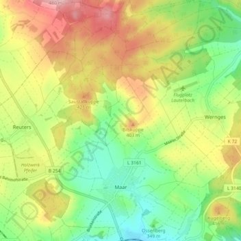
Name: Maar topographic map, elevation, terrain.
Location: Maar, Lauterbach (Hessen), Vogelsbergkreis, Hessen, Duitsland (50.64737 9.35088 50.70406 9.42864)
Average elevation: 373 m
Minimum elevation: 294 m
Maximum elevation: 474 m
Thank you for supporting this site ❤️
Make a donation
Make a donation
Other topographic maps
Click on a map to view its topography, its elevation and its terrain.