
Thank you for supporting this site ❤️
Make a donation
Make a donation
Salmo topographic map
Click on the map to display elevation.
Thank you for supporting this site ❤️
Make a donation
Make a donation
About this map
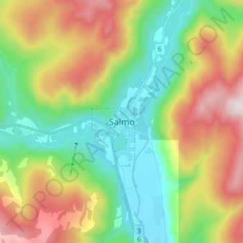
Name: Salmo topographic map, elevation, terrain.
Average elevation: 1,049 m
Minimum elevation: 641 m
Maximum elevation: 1,730 m
Thank you for supporting this site ❤️
Make a donation
Make a donation
Other topographic maps
Click on a map to view its topography, its elevation and its terrain.
Area A (Wynndel/Crawford Bay/Riondel)
Canada > British Columbia > Regional District of Central Kootenay
Average elevation: 1,574 m