
Thank you for supporting this site ❤️
Make a donation
Make a donation
Rimbayan topographic map
Click on the map to display elevation.
Thank you for supporting this site ❤️
Make a donation
Make a donation
About this map
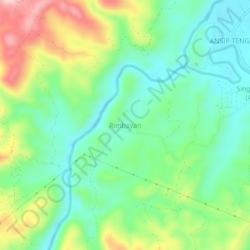
Name: Rimbayan topographic map, elevation, terrain.
Location: Rimbayan, Keningau, Interior Division, Sabah, Malaysia (5.24516 116.08400 5.28516 116.12400)
Average elevation: 322 m
Minimum elevation: 234 m
Maximum elevation: 492 m
Thank you for supporting this site ❤️
Make a donation
Make a donation
Other topographic maps
Click on a map to view its topography, its elevation and its terrain.