
Xian County topographic map
Interactive map
Click on the map to display elevation.
About this map
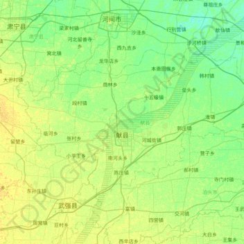
Name: Xian County topographic map, elevation, terrain.
Location: Xian County, Cangzhou, Hebei, 062200, China (38.05917 115.82438 38.37492 116.49960)
Average elevation: 15 m
Minimum elevation: 8 m
Maximum elevation: 23 m
Other topographic maps
Click on a map to view its topography, its elevation and its terrain.
Zhaocun
China > Hebei > Baoding City > Zhaocun
Zhaocun, Baoding City, Hebei, China
Average elevation: 13 m
Qinhuangdao City
China > Hebei > Qinhuangdao City
Qinhuangdao City, Hebei, China
Average elevation: 150 m
Shijiazhuang City
China > Hebei > Shijiazhuang City
Shijiazhuang City, Hebei, China
Average elevation: 337 m