
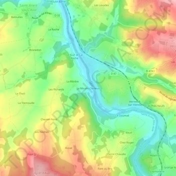
Le Moulin Clédaud topographic map
Interactive map
Click on the map to display elevation.
About this map
Name: Le Moulin Clédaud topographic map, elevation, terrain.
Average elevation: 245 m
Minimum elevation: 181 m
Maximum elevation: 326 m
Other topographic maps
Click on a map to view its topography, its elevation and its terrain.
La Tremouille
France > Nouvelle-Aquitaine > Haute-Vienne > Saint-Priest-sous-Aixe
La Tremouille, Saint-Priest-sous-Aixe, Limoges, Haute-Vienne, Nouvelle-Aquitaine, France métropolitaine, 87700, France
Average elevation: 272 m
Le Clos
France > Nouvelle-Aquitaine > Haute-Vienne > Saint-Priest-sous-Aixe > Le Clos
Le Clos, Saint-Priest-sous-Aixe, Limoges, Haute-Vienne, Nouvelle-Aquitaine, France métropolitaine, 87700, France
Average elevation: 253 m