
Thank you for supporting this site ❤️
Make a donation
Make a donation
Teniente Hugo Ortiz topographic map
Click on the map to display elevation.
Thank you for supporting this site ❤️
Make a donation
Make a donation
About this map
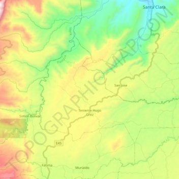
Name: Teniente Hugo Ortiz topographic map, elevation, terrain.
Location: Teniente Hugo Ortiz, Pastaza, Ecuador (-1.40561 -78.00628 -1.29385 -77.81990)
Average elevation: 1,008 m
Minimum elevation: 557 m
Maximum elevation: 2,031 m
Thank you for supporting this site ❤️
Make a donation
Make a donation
Other topographic maps
Click on a map to view its topography, its elevation and its terrain.