
Ötztaler Alpen topographic map
Interactive map
Click on the map to display elevation.
About this map
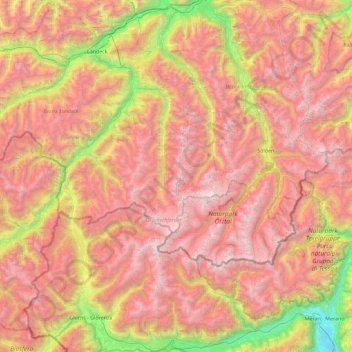
Name: Ötztaler Alpen topographic map, elevation, terrain.
Location: Ötztaler Alpen, Kaunertal, Landeck, Tirol, Oostenrijk (46.61034 10.48532 47.23228 11.24258)
Average elevation: 2,098 m
Minimum elevation: 257 m
Maximum elevation: 3,723 m
Other topographic maps
Click on a map to view its topography, its elevation and its terrain.
Hochvernagtspitze
Oostenrijk > Tirol > Kaunertal
Hochvernagtspitze, Kaunertal, Landeck, Tirol, Oostenrijk
Average elevation: 3,113 m