
Thank you for supporting this site ❤️
Make a donation
Make a donation
Guerlange topographic map
Click on the map to display elevation.
Thank you for supporting this site ❤️
Make a donation
Make a donation
About this map
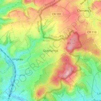
Name: Guerlange topographic map, elevation, terrain.
Location: Guerlange, Aubange, Arlon, Luxembourg, Wallonie, 6791, Belgique (49.56188 5.83439 49.60188 5.87439)
Average elevation: 325 m
Minimum elevation: 267 m
Maximum elevation: 389 m
Thank you for supporting this site ❤️
Make a donation
Make a donation