
Thank you for supporting this site ❤️
Make a donation
Make a donation
Lăstuni topographic map
Click on the map to display elevation.
Thank you for supporting this site ❤️
Make a donation
Make a donation
About this map
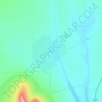
Name: Lăstuni topographic map, elevation, terrain.
Location: Lăstuni, Mihail Kogălniceanu, Tulcea, 827146, Romania (45.00718 28.67698 45.04718 28.71698)
Average elevation: 36 m
Minimum elevation: 8 m
Maximum elevation: 163 m
Thank you for supporting this site ❤️
Make a donation
Make a donation
Other topographic maps
Click on a map to view its topography, its elevation and its terrain.
Thank you for supporting this site ❤️
Make a donation
Make a donation
Thank you for supporting this site ❤️
Make a donation
Make a donation
Thank you for supporting this site ❤️
Make a donation
Make a donation
Thank you for supporting this site ❤️
Make a donation
Make a donation