
Thank you for supporting this site ❤️
Make a donation
Make a donation
Bojong Genteng topographic map
Click on the map to display elevation.
Thank you for supporting this site ❤️
Make a donation
Make a donation
About this map
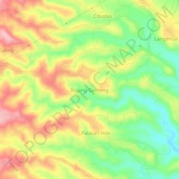
Name: Bojong Genteng topographic map, elevation, terrain.
Location: Bojong Genteng, Sukabumi, West Java, Java, Indonesia (-6.86642 106.70315 -6.82642 106.74315)
Average elevation: 467 m
Minimum elevation: 387 m
Maximum elevation: 548 m
Thank you for supporting this site ❤️
Make a donation
Make a donation