
Jala topographic map
Interactive map
Click on the map to display elevation.
About this map
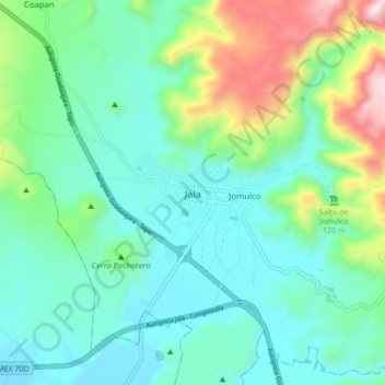
Name: Jala topographic map, elevation, terrain.
Location: Jala, Nayarit, 63890, Mexico (21.06312 -104.47684 21.14312 -104.39684)
Average elevation: 1,227 m
Minimum elevation: 1,015 m
Maximum elevation: 1,895 m