
Oradea topographic map
Interactive map
Click on the map to display elevation.
About this map
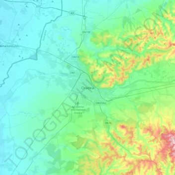
Name: Oradea topographic map, elevation, terrain.
Location: Oradea, Bihor, 410640, Roemenië (46.89492 21.76852 47.21492 22.08852)
Average elevation: 155 m
Minimum elevation: 94 m
Maximum elevation: 421 m