
Tschetschenien topographic map
Interactive map
Click on the map to display elevation.
About this map
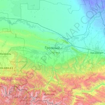
Name: Tschetschenien topographic map, elevation, terrain.
Location: Tschetschenien, Föderationskreis Nordkaukasus, Russland (42.47577 44.83320 44.00858 46.66204)
Average elevation: 751 m
Minimum elevation: -17 m
Maximum elevation: 4,417 m
Other topographic maps
Click on a map to view its topography, its elevation and its terrain.
Tschetschenien
Tschetschenien, Föderationskreis Nordkaukasus, Russland
Average elevation: 643 m