
Bolívar topographic map
Interactive map
Click on the map to display elevation.
About this map
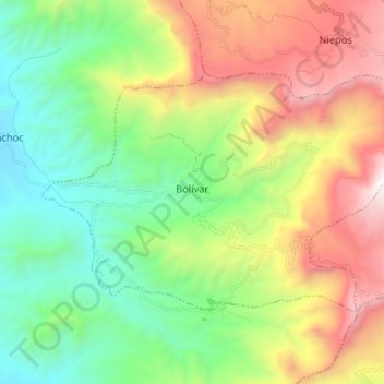
Name: Bolívar topographic map, elevation, terrain.
Location: Bolívar, San Miguel, Cajamarca, Peru (-7.01841 -79.22963 -6.93726 -79.09944)
Average elevation: 1,376 m
Minimum elevation: 383 m
Maximum elevation: 3,108 m