
Santo Tomas topographic map
Interactive map
Click on the map to display elevation.
About this map
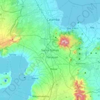
Name: Santo Tomas topographic map, elevation, terrain.
Location: Santo Tomas, Batangas, Calabarzon, 4234, Philippines (13.94784 120.98533 14.26784 121.30533)
Average elevation: 154 m
Minimum elevation: -4 m
Maximum elevation: 1,073 m