
Thank you for supporting this site ❤️
Make a donation
Make a donation
Higher Kinnerton topographic map
Click on the map to display elevation.
Thank you for supporting this site ❤️
Make a donation
Make a donation
About this map
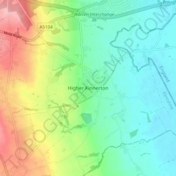
Name: Higher Kinnerton topographic map, elevation, terrain.
Location: Higher Kinnerton, Flintshire, Wales, CH4 9BA, United Kingdom (53.12396 -3.02344 53.16396 -2.98344)
Average elevation: 52 m
Minimum elevation: 7 m
Maximum elevation: 141 m
Thank you for supporting this site ❤️
Make a donation
Make a donation
Other topographic maps
Click on a map to view its topography, its elevation and its terrain.