
Ndoukoula topographic map
Interactive map
Click on the map to display elevation.
About this map
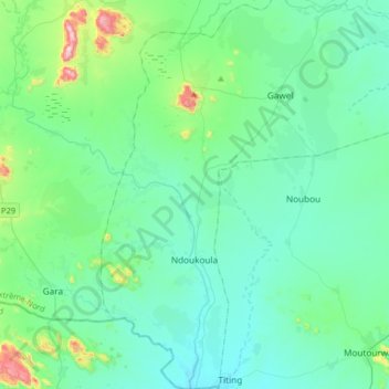
Name: Ndoukoula topographic map, elevation, terrain.
Location: Ndoukoula, Diamaré, Région de l'Extrême-Nord, Cameroun (10.16822 13.94918 10.48787 14.26832)
Average elevation: 485 m
Minimum elevation: 403 m
Maximum elevation: 930 m