
Thank you for supporting this site ❤️
Make a donation
Make a donation
Alto Naranjillo topographic map
Click on the map to display elevation.
Thank you for supporting this site ❤️
Make a donation
Make a donation
About this map
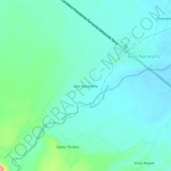
Name: Alto Naranjillo topographic map, elevation, terrain.
Location: Alto Naranjillo, Awajún, Rioja, San Martín, Perú (-5.83234 -77.43011 -5.79234 -77.39011)
Average elevation: 910 m
Minimum elevation: 872 m
Maximum elevation: 1,080 m
Thank you for supporting this site ❤️
Make a donation
Make a donation
Other topographic maps
Click on a map to view its topography, its elevation and its terrain.