
Thank you for supporting this site ❤️
Make a donation
Make a donation
Goodnight topographic map
Click on the map to display elevation.
Thank you for supporting this site ❤️
Make a donation
Make a donation
About this map
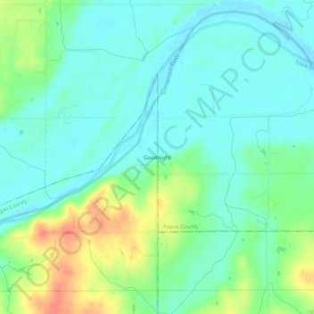
Name: Goodnight topographic map, elevation, terrain.
Location: Goodnight, Logan County, Oklahoma, United States (35.93144 -97.16059 35.97144 -97.12059)
Average elevation: 271 m
Minimum elevation: 256 m
Maximum elevation: 305 m
Thank you for supporting this site ❤️
Make a donation
Make a donation
Other topographic maps
Click on a map to view its topography, its elevation and its terrain.