
Thank you for supporting this site ❤️
Make a donation
Make a donation
Mill City topographic map
Click on the map to display elevation.
Thank you for supporting this site ❤️
Make a donation
Make a donation
About this map
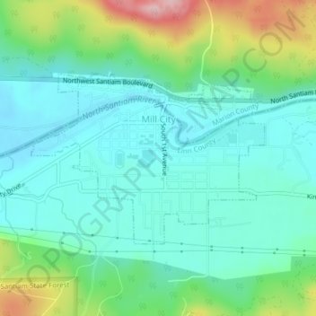
Name: Mill City topographic map, elevation, terrain.
Location: Mill City, Linn County, Oregon, 97360, United States (44.74332 -122.49346 44.75792 -122.46539)
Average elevation: 292 m
Minimum elevation: 238 m
Maximum elevation: 447 m
Thank you for supporting this site ❤️
Make a donation
Make a donation
Other topographic maps
Click on a map to view its topography, its elevation and its terrain.