
Thank you for supporting this site ❤️
Make a donation
Make a donation
Jessieville topographic map
Click on the map to display elevation.
Thank you for supporting this site ❤️
Make a donation
Make a donation
About this map
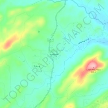
Name: Jessieville topographic map, elevation, terrain.
Location: Jessieville, Garland County, Arkansas, 71910, United States (34.68120 -93.08157 34.72120 -93.04157)
Average elevation: 238 m
Minimum elevation: 193 m
Maximum elevation: 351 m
Thank you for supporting this site ❤️
Make a donation
Make a donation
Other topographic maps
Click on a map to view its topography, its elevation and its terrain.