
Thank you for supporting this site ❤️
Make a donation
Make a donation
Kotasari topographic map
Click on the map to display elevation.
Thank you for supporting this site ❤️
Make a donation
Make a donation
About this map
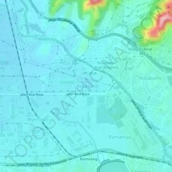
Name: Kotasari topographic map, elevation, terrain.
Location: Kotasari, Cilegon, Java, 42436, Indonesia (-6.01396 106.00252 -5.97396 106.04252)
Average elevation: 21 m
Minimum elevation: 1 m
Maximum elevation: 174 m
Thank you for supporting this site ❤️
Make a donation
Make a donation