
Thank you for supporting this site ❤️
Make a donation
Make a donation
Khamir topographic map
Click on the map to display elevation.
Thank you for supporting this site ❤️
Make a donation
Make a donation
About this map
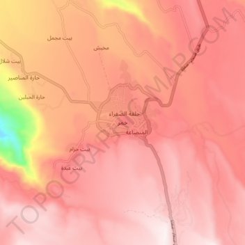
Name: Khamir topographic map, elevation, terrain.
Location: Khamir, Khamir District, 'Amran Governorate, Yemen (15.94827 43.91349 16.02827 43.99349)
Average elevation: 2,447 m
Minimum elevation: 1,823 m
Maximum elevation: 2,665 m
Thank you for supporting this site ❤️
Make a donation
Make a donation
Other topographic maps
Click on a map to view its topography, its elevation and its terrain.