
Thank you for supporting this site ❤️
Make a donation
Make a donation
Plainfield topographic map
Click on the map to display elevation.
Thank you for supporting this site ❤️
Make a donation
Make a donation
About this map
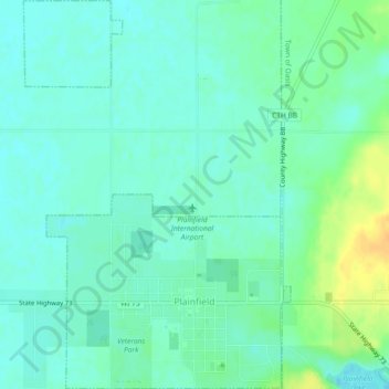
Name: Plainfield topographic map, elevation, terrain.
Location: Plainfield, Waushara County, Wisconsin, 54966, United States (44.20647 -89.51247 44.23926 -89.48099)
Average elevation: 342 m
Minimum elevation: 333 m
Maximum elevation: 362 m
Thank you for supporting this site ❤️
Make a donation
Make a donation
Other topographic maps
Click on a map to view its topography, its elevation and its terrain.