15-21-01-K12-0002 topographic map
Interactive map
Click on the map to display elevation.
About this map
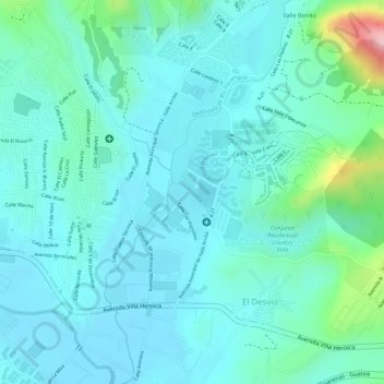
Name: 15-21-01-K12-0002 topographic map, elevation, terrain.
Average elevation: 333 m
Minimum elevation: 297 m
Maximum elevation: 487 m

Click on the map to display elevation.
Name: 15-21-01-K12-0002 topographic map, elevation, terrain.
Average elevation: 333 m
Minimum elevation: 297 m
Maximum elevation: 487 m