
National Center for Atmospheric Research topographic map
Interactive map
Click on the map to display elevation.
About this map
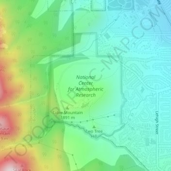
Name: National Center for Atmospheric Research topographic map, elevation, terrain.
Average elevation: 1,816 m
Minimum elevation: 1,644 m
Maximum elevation: 2,254 m
Other topographic maps
Click on a map to view its topography, its elevation and its terrain.
Boulder
United States > Colorado > Boulder County > Boulder
Boulder, Boulder County, Colorado, 80306, United States
Average elevation: 1,977 m