
Thank you for supporting this site ❤️
Make a donation
Make a donation
Woesten topographic map
Click on the map to display elevation.
Thank you for supporting this site ❤️
Make a donation
Make a donation
About this map
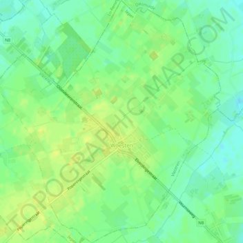
Name: Woesten topographic map, elevation, terrain.
Location: Woesten, Vleteren, Ypres, Flandre-Occidentale, Flandre, Belgique (50.88796 2.76479 50.91896 2.81053)
Average elevation: 13 m
Minimum elevation: 4 m
Maximum elevation: 20 m
Thank you for supporting this site ❤️
Make a donation
Make a donation
Other topographic maps
Click on a map to view its topography, its elevation and its terrain.
Champ de bataille préservé <<Colline 60>> (1ière Guerre mondiale)
Belgique > Flandre-Occidentale > Ypres > Ypres > Zillebeke > Zwarte Leen
Average elevation: 45 m
Haringe
Belgique > Flandre-Occidentale > Ypres > Poperinge > Roesbrugge-Haringe
Average elevation: 9 m