
City Of Kalamunda topographic map
Interactive map
Click on the map to display elevation.
About this map
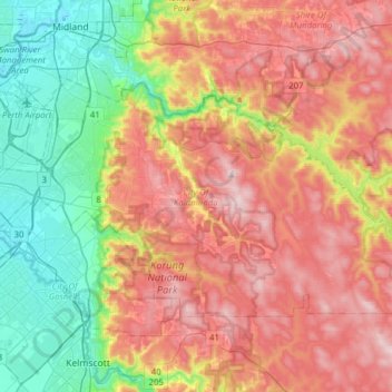
Name: City Of Kalamunda topographic map, elevation, terrain.
Location: City Of Kalamunda, Western Australia, Australia (-32.08516 115.97717 -31.92247 116.28897)
Average elevation: 189 m
Minimum elevation: 1 m
Maximum elevation: 394 m
Other topographic maps
Click on a map to view its topography, its elevation and its terrain.