
Col du Marchairuz topographic map
Interactive map
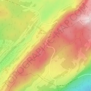
Click on the map to display elevation.
About this map
Name: Col du Marchairuz topographic map, elevation, terrain.
Average elevation: 1,378 m
Minimum elevation: 1,161 m
Maximum elevation: 1,526 m
Other topographic maps
Click on a map to view its topography, its elevation and its terrain.
Le Solliat
Suisse > Vaud > District du Jura-Nord vaudois > Le Chenit
Le Solliat, Le Chenit, District du Jura-Nord vaudois, Vaud, 1347, Suisse
Average elevation: 1,116 m