
Logan topographic map
Click on the map to display elevation.
About this map
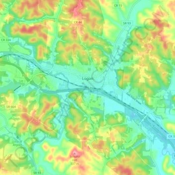
Name: Logan topographic map, elevation, terrain.
Location: Logan, Hocking County, Ohio, 43138, United States (39.51046 -82.46156 39.56086 -82.36054)
Average elevation: 254 m
Minimum elevation: 208 m
Maximum elevation: 336 m
Other topographic maps
Click on a map to view its topography, its elevation and its terrain.