
Viktring topographic map
Interactive map
Click on the map to display elevation.
About this map
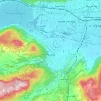
Name: Viktring topographic map, elevation, terrain.
Location: Viktring, Klagenfurt am Wörthersee, Kärnten, 9073, Österreich (46.57438 14.23642 46.61857 14.32776)
Average elevation: 518 m
Minimum elevation: 431 m
Maximum elevation: 791 m