
Thank you for supporting this site ❤️
Make a donation
Make a donation
San Antero topographic map
Click on the map to display elevation.
Thank you for supporting this site ❤️
Make a donation
Make a donation
About this map
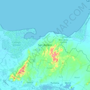
Name: San Antero topographic map, elevation, terrain.
Location: San Antero, Costanera, Córdoba, RAP Caribe, Colombia (9.21302 -75.91951 9.53302 -75.59951)
Average elevation: 17 m
Minimum elevation: -2 m
Maximum elevation: 240 m
Thank you for supporting this site ❤️
Make a donation
Make a donation