
Thank you for supporting this site ❤️
Make a donation
Make a donation
New Brighton topographic map
Click on the map to display elevation.
Thank you for supporting this site ❤️
Make a donation
Make a donation
About this map
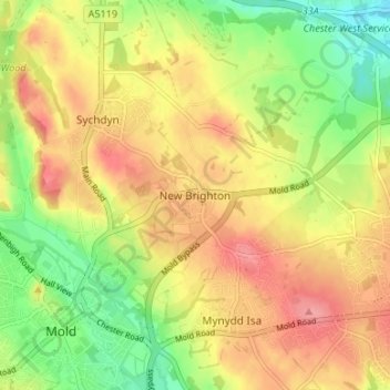
Name: New Brighton topographic map, elevation, terrain.
Location: New Brighton, Flintshire, Wales, CH7 6QT, United Kingdom (53.16054 -3.13850 53.20054 -3.09850)
Average elevation: 131 m
Minimum elevation: 84 m
Maximum elevation: 172 m
Thank you for supporting this site ❤️
Make a donation
Make a donation
Other topographic maps
Click on a map to view its topography, its elevation and its terrain.