
La Victoria topographic map
Interactive map
Click on the map to display elevation.
About this map
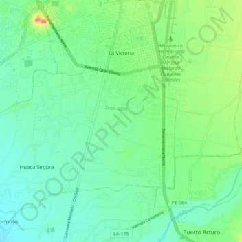
Name: La Victoria topographic map, elevation, terrain.
Location: La Victoria, Chiclayo, Lambayeque, 14000, Pérou (-6.85427 -79.91138 -6.78427 -79.82458)
Average elevation: 24 m
Minimum elevation: 8 m
Maximum elevation: 61 m
Other topographic maps
Click on a map to view its topography, its elevation and its terrain.