
Thank you for supporting this site ❤️
Make a donation
Make a donation
راستی topographic map
Click on the map to display elevation.
Thank you for supporting this site ❤️
Make a donation
Make a donation
About this map
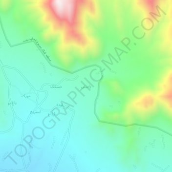
Name: راستی topographic map, elevation, terrain.
Location: راستی, دهستان سخوید, بخش نیر, Taft County, Yazd Province, Iran (31.48915 54.05674 31.52915 54.09674)
Average elevation: 2,629 m
Minimum elevation: 2,429 m
Maximum elevation: 3,150 m
Thank you for supporting this site ❤️
Make a donation
Make a donation