
Thank you for supporting this site ❤️
Make a donation
Make a donation
Courcelles topographic map
Click on the map to display elevation.
Thank you for supporting this site ❤️
Make a donation
Make a donation
About this map
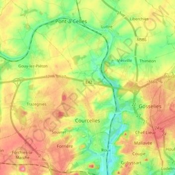
Name: Courcelles topographic map, elevation, terrain.
Location: Courcelles, Charleroi, Hainaut, Wallonie, 6180, Belgique (50.42743 4.28696 50.52383 4.40520)
Average elevation: 151 m
Minimum elevation: 104 m
Maximum elevation: 203 m
Thank you for supporting this site ❤️
Make a donation
Make a donation
Other topographic maps
Click on a map to view its topography, its elevation and its terrain.
Thank you for supporting this site ❤️
Make a donation
Make a donation
Thank you for supporting this site ❤️
Make a donation
Make a donation