
Thank you for supporting this site ❤️
Make a donation
Make a donation
Llanishen topographic map
Click on the map to display elevation.
Thank you for supporting this site ❤️
Make a donation
Make a donation
About this map
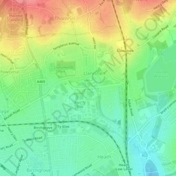
Name: Llanishen topographic map, elevation, terrain.
Location: Llanishen, Cardiff, Wales, United Kingdom (51.51777 -3.20618 51.53598 -3.16660)
Average elevation: 52 m
Minimum elevation: 20 m
Maximum elevation: 100 m
Thank you for supporting this site ❤️
Make a donation
Make a donation
Other topographic maps
Click on a map to view its topography, its elevation and its terrain.