
Oberhausen topographic map
Interactive map
Click on the map to display elevation.
About this map
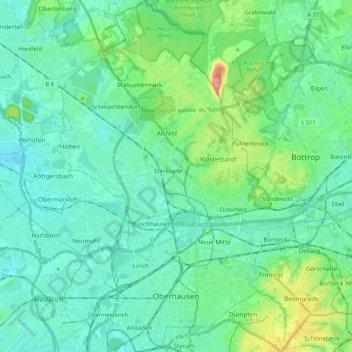
Name: Oberhausen topographic map, elevation, terrain.
Location: Oberhausen, Rhénanie-du-Nord-Westphalie, Allemagne (51.44870 6.77733 51.57999 6.93046)
Average elevation: 46 m
Minimum elevation: 17 m
Maximum elevation: 170 m