
Kang topographic map
Interactive map
Click on the map to display elevation.
About this map
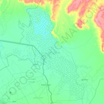
Name: Kang topographic map, elevation, terrain.
Location: Kang, Nimruz Province, Afghanistan (31.02554 61.60124 31.65172 62.06400)
Average elevation: 491 m
Minimum elevation: 468 m
Maximum elevation: 609 m
Other topographic maps
Click on a map to view its topography, its elevation and its terrain.
Chahar Burjak
Chahar Burjak, Nimruz Province, Afghanistan
Average elevation: 672 m