
Ясногорский район topographic map
Interactive map
Click on the map to display elevation.
About this map
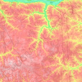
Name: Ясногорский район topographic map, elevation, terrain.
Average elevation: 211 m
Minimum elevation: 98 m
Maximum elevation: 280 m
Other topographic maps
Click on a map to view its topography, its elevation and its terrain.
Jasnogorsk
Russland > Oblast Tula > Jasnogorsk
Jasnogorsk, Ясногорский район, Oblast Tula, Föderationskreis Zentralrussland, 301030, Russland
Average elevation: 237 m