
Thank you for supporting this site ❤️
Make a donation
Make a donation
El Agna topographic map
Click on the map to display elevation.
Thank you for supporting this site ❤️
Make a donation
Make a donation
About this map
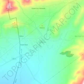
Name: El Agna topographic map, elevation, terrain.
Location: El Agna, Gosbat, Ras El Aïoun district, Batna, 19015, Algeria (35.66957 5.42183 35.70957 5.46183)
Average elevation: 1,004 m
Minimum elevation: 896 m
Maximum elevation: 1,270 m
Thank you for supporting this site ❤️
Make a donation
Make a donation