
Fräkmüntegg topographic map
Interactive map
Click on the map to display elevation.
About this map
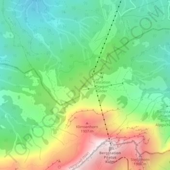
Name: Fräkmüntegg topographic map, elevation, terrain.
Location: Fräkmüntegg, Hergiswil (NW), Nidwald, 6052, Suisse (46.97922 8.23971 46.99922 8.25971)
Average elevation: 1,374 m
Minimum elevation: 972 m
Maximum elevation: 2,094 m
Other topographic maps
Click on a map to view its topography, its elevation and its terrain.
Hergiswil (NW)
Suisse > Nidwald > Hergiswil (NW)
Hergiswil (NW), Nidwald, 6052, Suisse
Average elevation: 676 m