
Sint-Bernard topographic map
Interactive map
Click on the map to display elevation.
About this map
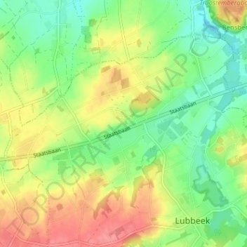
Name: Sint-Bernard topographic map, elevation, terrain.
Location: Sint-Bernard, Lubbeek, Leuven, Vlaams-Brabant, 3210, België (50.87727 4.80387 50.91727 4.84387)
Average elevation: 61 m
Minimum elevation: 29 m
Maximum elevation: 102 m