
Thank you for supporting this site ❤️
Make a donation
Make a donation
Casper topographic map
Click on the map to display elevation.
Thank you for supporting this site ❤️
Make a donation
Make a donation
About this map
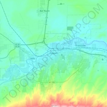
Name: Casper topographic map, elevation, terrain.
Location: Casper, Natrona County, Wyoming, United States (42.79129 -106.43497 42.90753 -106.21571)
Average elevation: 1,635 m
Minimum elevation: 1,546 m
Maximum elevation: 2,010 m
Thank you for supporting this site ❤️
Make a donation
Make a donation