
Aisemont topographic map
Interactive map
Click on the map to display elevation.
About this map
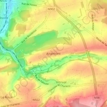
Name: Aisemont topographic map, elevation, terrain.
Location: Aisemont, Fosses-la-Ville, Namur, Wallonie, 5070, Belgique (50.38486 4.63132 50.42486 4.67132)
Average elevation: 175 m
Minimum elevation: 100 m
Maximum elevation: 240 m