
Autafond topographic map
Interactive map
Click on the map to display elevation.
About this map
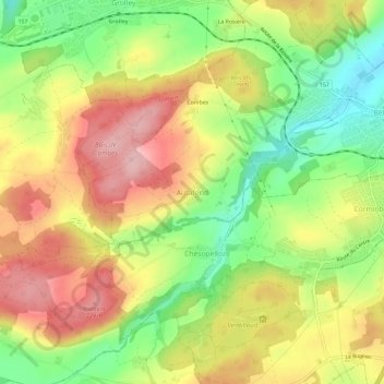
Name: Autafond topographic map, elevation, terrain.
Location: Autafond, District de la Sarine, Fribourg, 1782, Suisse (46.79335 7.05733 46.83335 7.09733)
Average elevation: 652 m
Minimum elevation: 562 m
Maximum elevation: 740 m