
Thank you for supporting this site ❤️
Make a donation
Make a donation
Parc Maximilien topographic map
Click on the map to display elevation.
Thank you for supporting this site ❤️
Make a donation
Make a donation
About this map
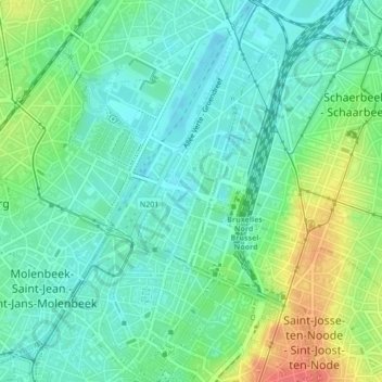
Name: Parc Maximilien topographic map, elevation, terrain.
Location: Parc Maximilien, Bruxelles, Bruxelles-Capitale, 1000, Belgique (50.85792 4.34927 50.86503 4.35662)
Average elevation: 30 m
Minimum elevation: 12 m
Maximum elevation: 68 m
Thank you for supporting this site ❤️
Make a donation
Make a donation
Other topographic maps
Click on a map to view its topography, its elevation and its terrain.