
san topographic map
Click on the map to display elevation.
About this map
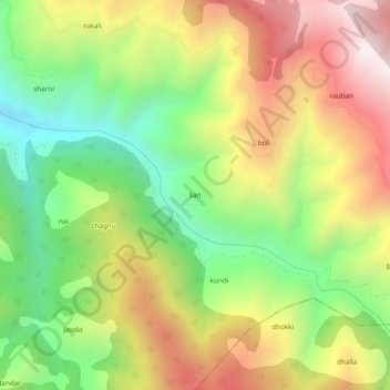
Name: san topographic map, elevation, terrain.
Location: san, Thathri, Doda District, Jammu and Kashmir, India (33.07161 75.70443 33.11161 75.74443)
Average elevation: 1,928 m
Minimum elevation: 1,424 m
Maximum elevation: 2,513 m