
Thank you for supporting this site ❤️
Make a donation
Make a donation
Red Springs topographic map
Click on the map to display elevation.
Thank you for supporting this site ❤️
Make a donation
Make a donation
About this map
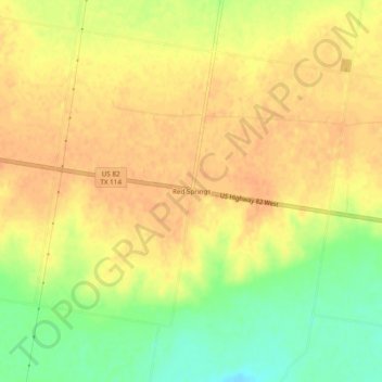
Name: Red Springs topographic map, elevation, terrain.
Location: Red Springs, Baylor County, Texas, United States (33.59289 -99.43204 33.63289 -99.39204)
Average elevation: 418 m
Minimum elevation: 394 m
Maximum elevation: 429 m
Thank you for supporting this site ❤️
Make a donation
Make a donation
Other topographic maps
Click on a map to view its topography, its elevation and its terrain.
Seymour
United States > Texas > Baylor County
The climate is humid subtropical (Köppen: Cfa) with an extreme temperature deviation, but much of the time, the variation is always more and the warm weather prevails over the cold as the averages and the records show. Its subtropical location and south of the center of a large land mass bring occasional…
Average elevation: 401 m